
ISRO to Map, Create 3D Images of Heritage Sites in India
ISRO along with GOI will use its expertise and high quality satellite imagery to map heritage sites and then make plans to preserve them. Here's more to know.
ISRO along with GOI will use its expertise and high quality satellite imagery to map heritage sites and then make plans to preserve them. Here’s more to know.
Indian Space Research Organisation (ISRO) will soon be using all its expertise in preserving and monitoring heritage sites of India.


With rapid urbanisation and various development projects, many heritage sites are under risk and ISRO has now come to their rescue. ISRO will use its space technology to map the sites and monuments.
Along with the Ministry of Culture, GOI’s national body for inventory and monitoring of archaeological sites of the country, ISRO will use data from its satellites to map and generate 3D images of several heritage sites in the country and allow people to access virtual tours of these sites.
The systematic database of these heritage properties generated using the expert technology by ISRO will help in taking appropriate steps to plan and conserve the monuments and monitor the activities of the sites.
To map and recognise the heritage sites, ISRO will analyze the data coming in from satellites such as Cartosat-1, Cartosat-2 and Resourcesat LISS IV. This high resolution data will help in creating a Geo-spatial database of all world heritage sites and important monuments in the country.
Data like station survey data, revenue village cadastral maps and other maps, attributes related to the inventory, plans etc. will be made available using this technology.
In addition to these ground photographs, different views of the monuments, types of buildings and their heights, street views of the buildings and lanes, and open spaces will also be part of the database.
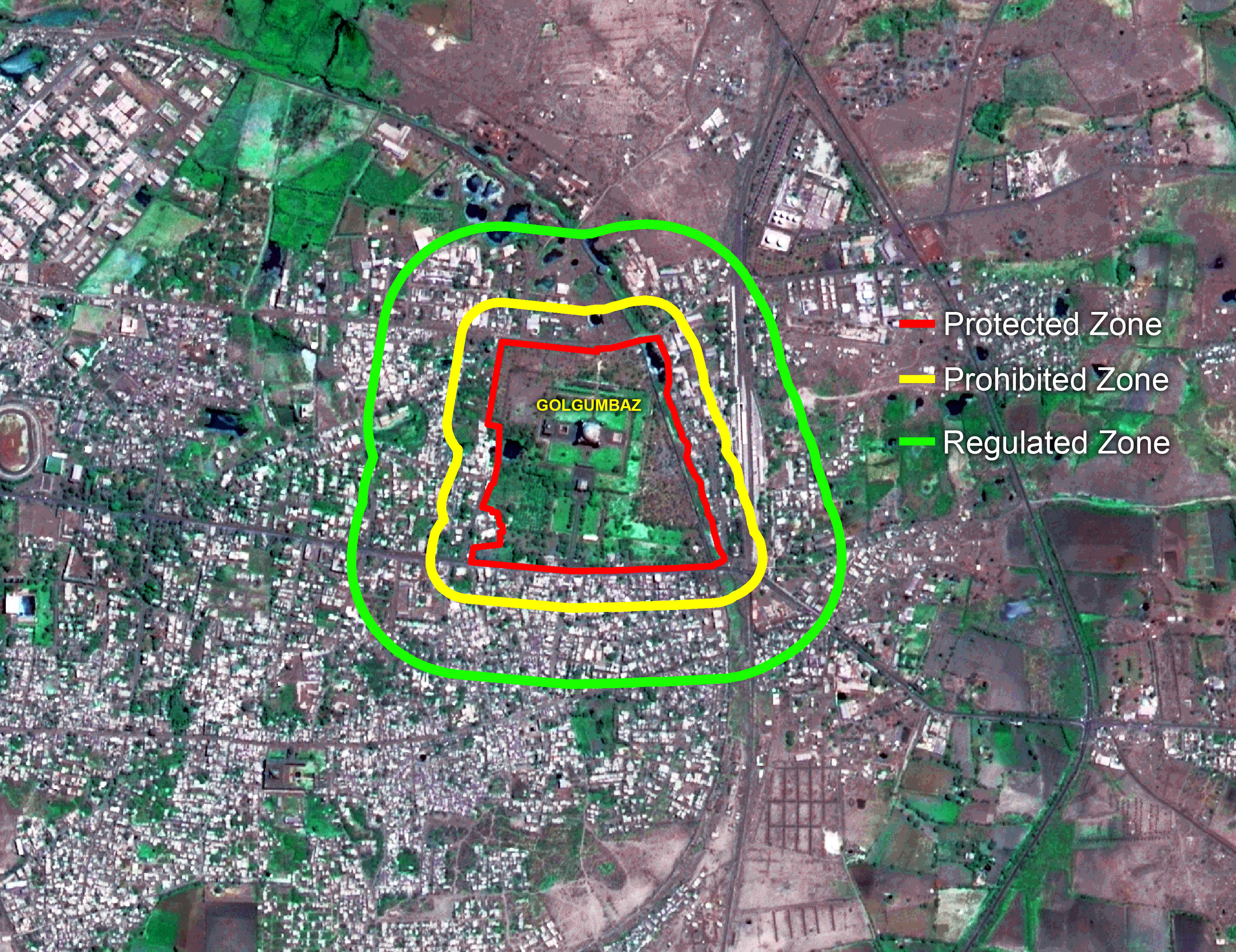
A Standard Operating Procedure (SOP) using high resolution satellite data as primary data source and employing state-of the-art Geo-spatial technology and open source tools has been developed for operational use by ASI for the project. The technology can further be modified with the changing needs of the organizations.
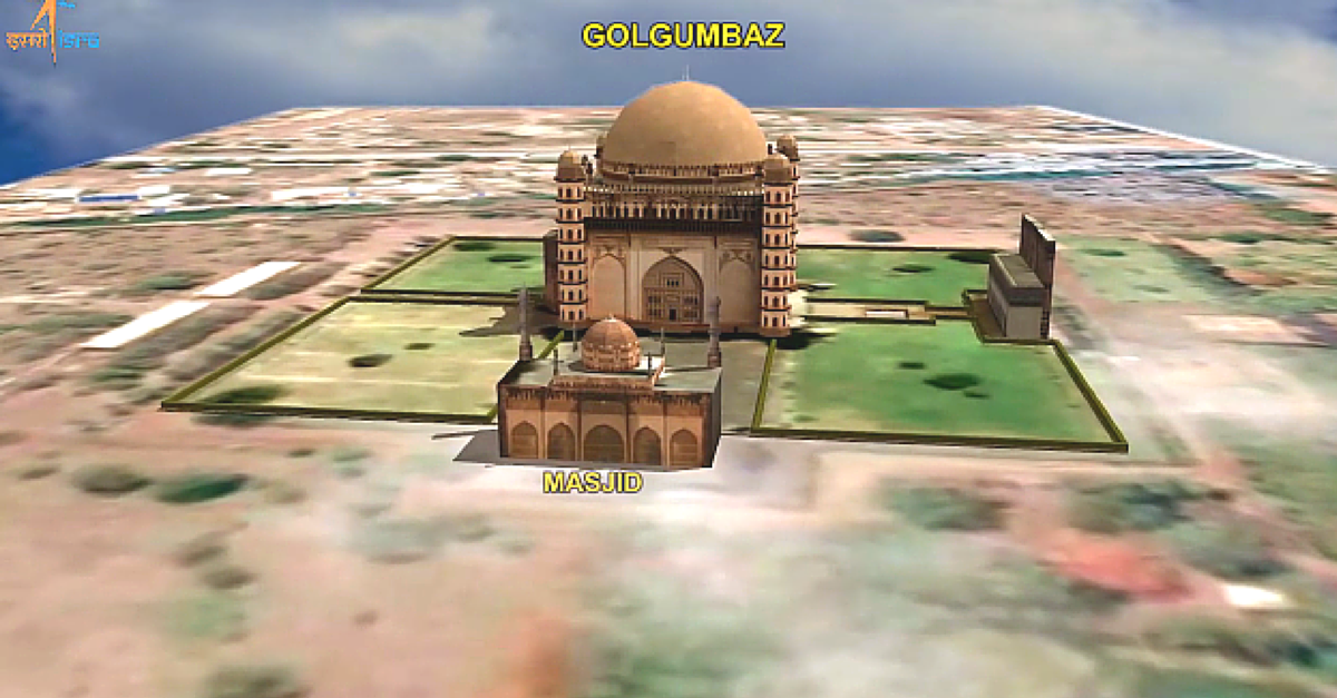
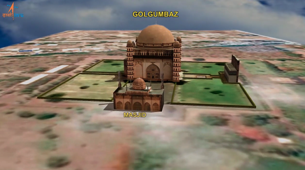
In collaboration with GOI and Archaeological Survey of India (ASI), ISRO has already mapped temples and monuments in Belur and Halebidu, Shravanabelagola, Gol Gumbaz in Bijapur, the pre-historic site of Chandravalli, fort and temples in Chitradurga, the fort and masonry elephants in Madikeri, and Tipu Sultan’s birth place in Devanahalli.
Here is a 3D digital model of Gol Gumbaz. Know more about the initiative here.

Photo sources: www.isro.gov.in
Like this story? Or have something to share? Write to us: [email protected], or connect with us on Facebook and Twitter (@thebetterindia).
This story made me
 97
97 121
121 89
89 167
167
Tell Us More

We bring stories straight from the heart of India, to inspire millions and create a wave of impact. Our positive movement is growing bigger everyday, and we would love for you to join it.
Please contribute whatever you can, every little penny helps our team in bringing you more stories that support dreams and spread hope.