ISRO Offers Free Online Course On Remote Sensing, With Certificate: How To Apply
The 15-week long course on ‘remote sensing, GIS and GNSS technology and their applications' will entail 77.5 hours of learning. The last date to apply is 31 January, 2021.
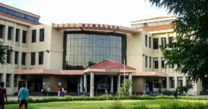
The Indian Space Research Organisation (ISRO) is inviting undergraduate students for a 15-week free online course on ‘remote sensing, GIS, and GNSS technology and their applications’. The course has been approved by the All India Council for Technical Education (AICTE).
What will you learn?
- The students will spend 77.5 hours, spanning over 15 weeks, learning about remote sensing, global navigation satellite system and geographic information system, and applications of geospatial technology.
- Students are also given the option of either registering for individual courses, or all three courses.
The course consists of four modules:
- Remote Sensing and Digital Image Analysis: Students will be taught basic principles of remote sensing, earth observation sensors and platforms, spectral signature of different land cover features, image interpretation, thermal, and microwave remote sensing. Additionally, they will also learn about digital image processing, which entails rectification and registration, enhancement, classification and accuracy assessment techniques.
- Global Navigation Satellite System: Students will learn about GPS and GNSS, receivers, processing methods, errors and accuracy.
- Geographical Information System: This entails learning about GIS, databases, topology, spatial analysis and open source software.
- RS and GIS Applications: Under this, students will learn about agriculture and soil, forestry and ecology, geoscience and geo-hazards, marine and atmospheric sciences, urban and regional studies, and water resources.
- Students will also see a practical demonstration using free and open-source software.
Things to know:
- This course will be conducted by the Indian Institute of Remote Sensing (IIRS) on the SWAYAM platform.
- On completing the course, the students will receive credit points.
- Dr. Poonam S Tiwari who is a scientist and teaching faculty at IIRS, ISRO, Dehradun, will conduct the course.
Important Dates:
- The course will start on 20 January 2021 and will be performed till May 5 2021.
- The last date to enroll for the course is 31 January 2021.
How to Apply:
- For more information on and to apply for this programme, one may visit the official website and click on the ‘join’ button.
(Edited by Divya Sethu)

This story made me
-
 97
97 -
 121
121 -
 89
89 -
 167
167
Tell Us More
If you found our story insightful, informative, or even just enjoyable, we invite you to consider making a voluntary payment to support the work we do at The Better India. Your contribution helps us continue producing quality content that educates, inspires, and drives positive change.
Choose one of the payment options below for your contribution-
By paying for the stories you value, you directly contribute to sustaining our efforts focused on making a difference in the world. Together, let's ensure that impactful stories continue to be told and shared, enriching lives and communities alike.
Thank you for your support. Here are some frequently asked questions you might find helpful to know why you are contributing?