
Meet the IFS Officer Who Built an Award-Winning System to Prevent Forest Fires
Thanks to him, forest fire incidences in Arunachal are down by 31% in just one year! #Respect
Last year, the world witnessed the worst fires to hit the Amazon Basin in Brazil in over a decade. This made international headlines with the fires destroying ecosystems and pumping climate warming pollution into the atmosphere. But these fires aren’t restricted to the Amazon.
Forest fires destroy millions of hectares of the world’s forests every year. Even the verdant forests of Arunachal Pradesh haven’t been spared of the same. With the lives of forest-dwelling communities and biodiversity at stake, we are left with no option but to find ways to predict and prevent these wildfires from consuming everything.


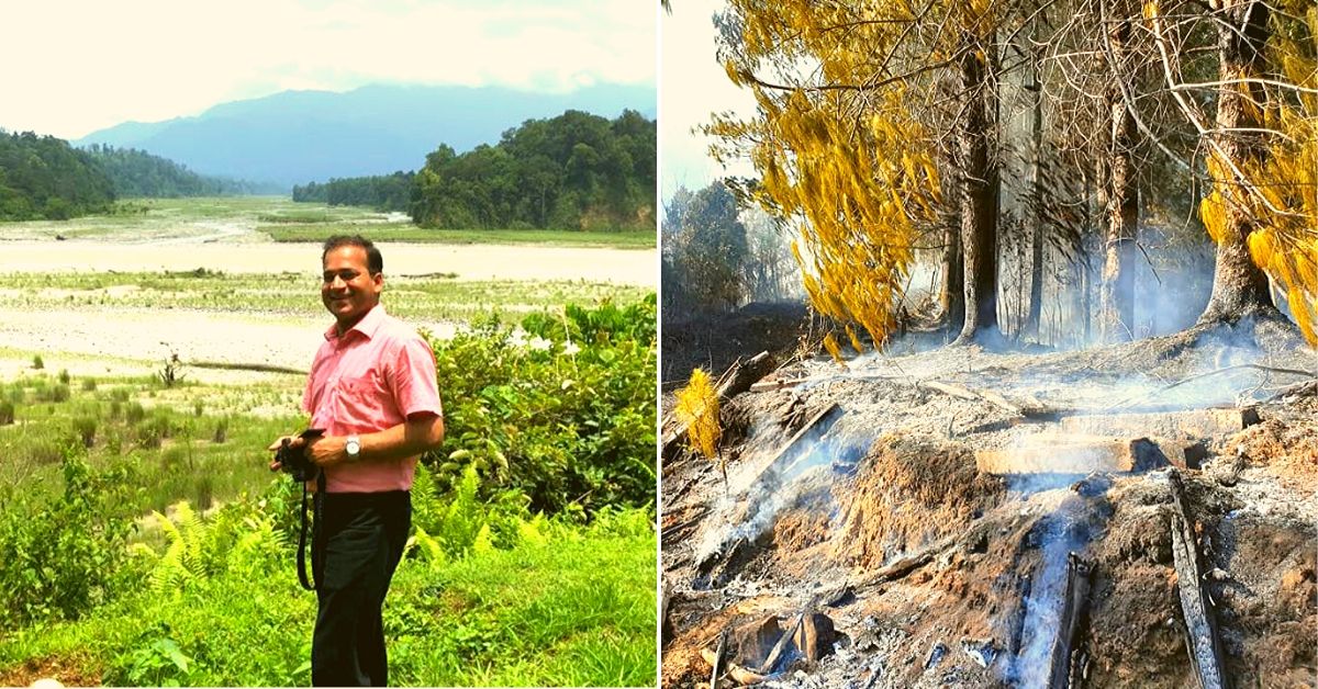
Introducing ‘eForestFire-Himalayan Forest Fire Prediction’, an e-governance initiative to predict forest fires in Arunachal Pradesh. The brainchild of 2013-batch Indian Forest Service officer Dr Abdul Qayum (AGMUT cadre), this system has “utilised decadal forest fire Forest Survey of India (FSI) data and mapped it on GIS platform with the objective to analyze forest fire events and their distribution to generate fire hotspots at the lowest administrative unit (village level),” says this video explainer.
Going further, it has “developed an efficient information dissemination system through a user friendly Android mobile App named eForestFire, linking fire data shared by citizens on a web GIS (geographic information system) portal,” the explainer goes onto add.
And the impact of this initiative has been immediate. When the initiative first took shape in 2017, a total of 6,551 cases of forest fires were reported in the state, while in the current financial year up to 7 December 2019, fire incidences were limited to 4,535 cases as reported by NASA through an email communication. In other words, the forest fire incidences reported this year were around 31 percent less in comparison to the period before the start of the initiative.
As a consequence of its success, the initiative bagged a national award for e-governance (Jury) at the Central government-organised National Conference on e-Governance earlier this year in Mumbai.
eForestFire Service was initially envisioned in September 2017. The first step was to characterise these forest fires in the state and the factors linked to them. Alongside academics Firoz Ahmad and Laxmi Goparaju, Qayum published a study on it in 2018.
Following the publication of this study, it was a fellow IFS officer Pradeep Mishra (MP Cadre) who assisted Dr Qayum in developing the app. With support from college mate Rakesh Sharma, who helped develop the GIS platform, the project also received the firm backing of RK Singh, the Principal Chief Conservator of Forests in Arunachal Pradesh.
By February 2019, the entire system finally came into play.
Who is Dr Abdul Qayum?
Born in the nondescript village Soharauna Raja of Maharajganj District in Uttar Pradesh, this son of a school teacher first studied at the local madrasa before earning a seat at the Jawahar Navodaya Vidyalaya Gorakhpur. Following school, Qayum obtained his B.Tech in civil engineering from IIT-Kanpur and PhD in Bioinformatics from JNU.
What attracted Qayum to the IFS was a realisation that India’s ecological future will go a long way in determining how it progresses. Without protecting India’s most vulnerable wildlife and forests, he feels that any economic progress is meaningless.
Since there was no better way to protect India’s precious forests and wildlife, he chose to join the IFS. Moreover, he has a burning desire to protect people dependent on the forests for their survival (vulnerable tribal communities), who are equal partners in the quest for conservation.
In many ways, Qayum’s latest brainchild encapsulates many of his objectives as an IFS officer from finding ways to better allocate resources in protecting forests to engaging local citizens. At the time of developing this system, he was the Divisional Forest Officer (DFO) of Tawang in Arunachal Pradesh. He is currently posted as the Deputy Conservator of Forest in Chandigarh.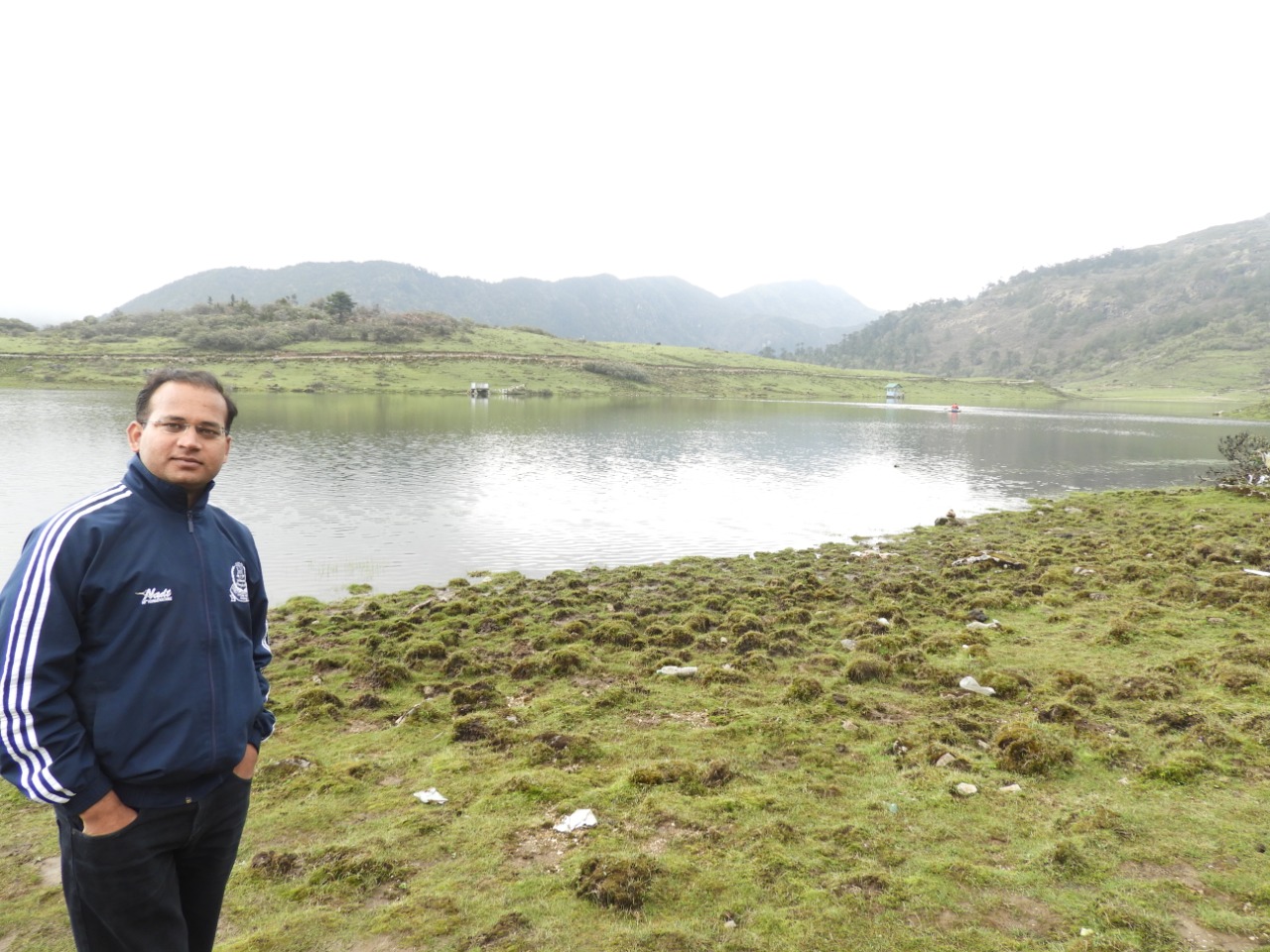
What causes forest fires in Arunachal Pradesh?
“The causes are primarily anthropogenic in nature, mostly out of human negligence or lack of awareness. It can result from something as innocuous as smoking a bidi or cigarette, and throwing it in the forest. However, there are those living on the fringes of forests who are dependent on it for survival. They deliberately light a fire which catches on and clears new ground for cultivation. The areas where poverty is high require greater attention for prevention of forest fires. There is also the ill-practice of shifting agriculture. Sometimes these fires go out of control and spread to larger areas,” says Qayum, speaking to The Better India.
But why do these fires spread? Qayum attributes it to the type of vegetation prevalent in these forests, particularly leaves that are shed during a particular season prone to catching fire. Using satellite imagery, his research team found that these fires mostly happen in moist deciduous forests. There are also species located in high altitude areas like pine that are susceptible to catching fire. In order to acquire cross validation for these findings, he led a research team which conducted an altitude wise study.
“…maximum number of forest fires occurred in tropical lowland forests, broadleaved, evergreen, <1000 m vegetation class (35%), while maximum number of fires (88%) was found in low elevation (<1500 m). The study has also reinforced the relationship between forest fire incidences and poverty as 42.3% incidence occurred in high to very high poverty index areas. Further a strong correlation was established with meteorological parameters such as relative humidity, precipitation, solar radiation and maximum temperature with fires fire, while minimum temperature and wind velocity were found to be nearly unrelated,” says this detailed paper published in 2018.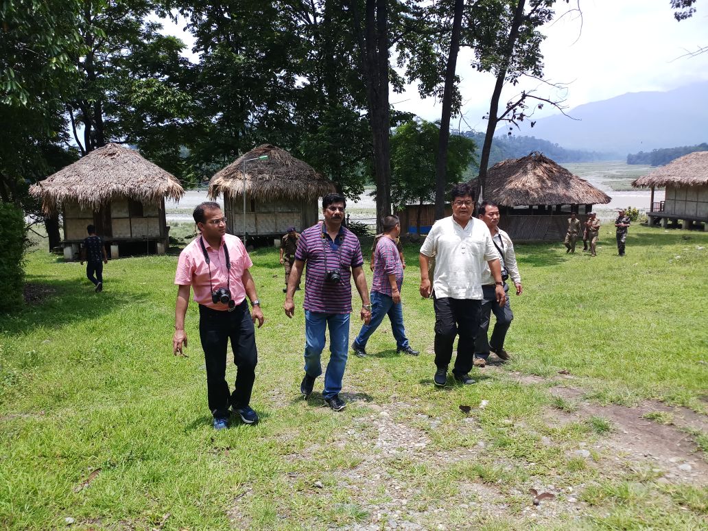
Gathering data
It’s the FSI which alerts respective state forest departments of forest fire locations detected by the MODIS (Moderate Resolution Imaging Spectro-radiometer) sensor onboard Aqua and Terra Satellites of NASA since 2004. Information is also relayed from the Visible Infrared Imaging Radiometer Suite data from the Suomi National Polar-orbiting Partnership (SNPP-VIIRS).
How is the information relayed? Here is process laid out in the State of Forest Report 2017:
1) Active fire sports or hotspots are received by NRSC *National Remote Sensing Centre), Hyderabad in their ground station at Shadnagar, Telangana and processes using Science Processing Algorithms (SPAs). The fire points are shared through email by NRSC to FSI.
2) The fire alerts provided by NRSC include all thermal anomalies detected by the sensors irrespective of whether these fall within or outside forests, FSI filters out all fires other than forest fires using a custom filter which is a combination of Recorded Forest Area boundaries as well as forest cover data. Enrichment of the forest fire information is carried out by adding attributes like State, District, Division, Range, Beat, Compartment boundaries etch to the forest fire locations. The information is then disseminated to State Nodal Officers, registered users and also uploaded on the website of FSI in the form of table and maps.
“Then the FSI relays that information to the State Forest Department headquarters. From there it is sent to the concerned District/Divisional Forest Officer (DFO). At the local level, the entire district is divided into ranges, which are further divided into blocks. So, the DFO receives the message of a forest fire taking place, who then relays it to the local range officer, and they have their own team that firefights. They recruit locals to firefight and use the equipment at their disposal to douse these fires,” says Qayum.
“From more than 6,000 cases of forest fires, it has come down to around 4500 with better predictive and preventive model of gauging forest fires. If monitoring and certain interventions are conducted, we can bring the number down further up to 2,000,” he adds.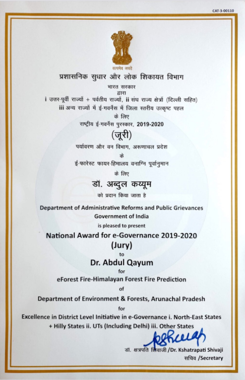
There are four segments to this system:
1) Mapping eight factors that are directly or indirectly linked to fires such as forest type, density, altitude, slope, rainfall data, temperature, poverty and population density. In light of these factors, eight maps were generated initially. These maps were integrated, giving certain weight to each factor which generated what he calls ‘Hotspot 1’. The team also obtained decadal data of forest fires in the state from the FSI, which generated ‘Hotspot 2’.
2) “The FSI data and the actual map we have produced citing direct and indirect factors are compared–where we predict forest fires are likely to happen and where actual fire points are reported. These maps are compared to find a percentage correlation. We obtained 70% correlation i.e. common points on both hotspots.
3) In the third part, Qayum and his team merged these two hotspots to improve the model. Out of over 5,258 villages in the state, they listed 560 villages which needed priority attention.
4) Subsequently, they developed this Android-based app called eForestFire, which has facilitated citizen-centric inputs from the public.
“The app is a Fire Reporting System, a scientific approach to ease governance by engaging people and promoting e-governance for the end users. It is designed specifically to work in offline mode which does not require any expertise and has the capability to deliver reports with just a click. Input is taken to get the exact location of the fire. After hitting the submit button, citizens can contact concerned District Forest Officer through email, WhatsApp or SMS by a predesigned standardised message or through a telephone or mobile call,” says Pradeep.
“Each input generates a data point which can be projected onto the web portal to get a bird’s eye view of state forest fire and revise the model with greater accuracy. The study that has been published in the Springer journal predicts a list of 560 priority villages of high forest fire risks. Fire points used had fewer data resolution, which comprised the project strength but the efficiency has been improved with citizen centric inputs through the app,” he adds.
Nearly 25% of the 560 villages fall under West Kameng district.
But what if there is no internet? Users can still click on the required options, and once you reach an internet-present area, information will be sent to the concerned DFO or you call them directly since their landline and mobile number are embedded on the app. This input then goes through a web portal called webgis.co.in. The app is specifically designed to work in offline mode considering the internet connectivity issues of the remote Himalayan state.
“The system is a union of data from direct and indirect factors, FSI, mobile app and web GIS portal. These are the four factors which are integrated to get the entire picture. At present we have a list of 560 high priority villages which we monitor for forest fires, but in a year or two this number will greatly reduce if proper implementation is done” says Qayum.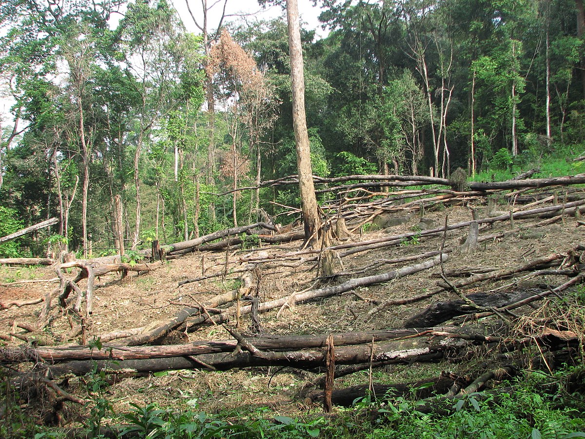
Efficient allocation of resources & public participation
With this system in place, the state now has a working model that can predict forest fires. This means the concerned forest officers have information of his/her villages that are susceptible to forest fires. Using this information, they can strategically establish fire lines that are used to prevent fire breaking into the forest from one patch to another using a constructed surface like a road or a water body. At present, there is no scientific input available in creating these fire lines.
With this information, officials can also better allocate watch and ward duties unlike earlier where it was randomly done, and set up watchtowers along these 560 priority villages. Besides raising awareness, engaging the public in fire fighting situations, this advanced information offered by this system helps the Forest Department allocate their limited resources strategically and efficiently. Building this system from scratch is a focussed intervention with real impact.
Also Read: Despite Death Threats, Fierce Official Frees 6,000 Hectares of Forest Land
“We have fire fighting equipment, but these fires are mitigated primarily because of active participation of the public. Since we sensitise them in advance that they are living in a fire prone area, we receive active support from them. At community level, there are certain groups that remain vigilant and pass on information to us like who is responsible for a particular fire. In Arunachal Pradesh, Gram Buras (GB), are village administrative heads with whom we keep in regular touch. They have their own internal arrangement of investigating and dishing out punishment to those starting fires,” informs Qayum.
However, a lot more needs to be done to prevent forest fires besides utilising this system. Since it’s a question of livelihood for certain communities who burn down forests to survive, governments, nonprofits and district administrations must initiate programmes that enhance their livelihood opportunities and reduce dependency on forest resources.
Having said that, using an accurate model to predict and mitigate them is a solid first step.
(Edited by Saiqua Sultan)
Like this story? Or have something to share? Write to us: [email protected], or connect with us on Facebook and Twitter.
This story made me
 97
97 121
121 89
89 167
167
Tell Us More

We bring stories straight from the heart of India, to inspire millions and create a wave of impact. Our positive movement is growing bigger everyday, and we would love for you to join it.
Please contribute whatever you can, every little penny helps our team in bringing you more stories that support dreams and spread hope.