
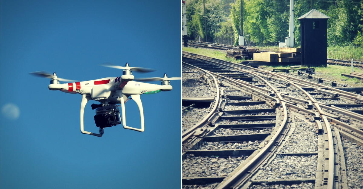
See a Drone Hovering over Train Tracks? Here’s What the Railways Is Doing
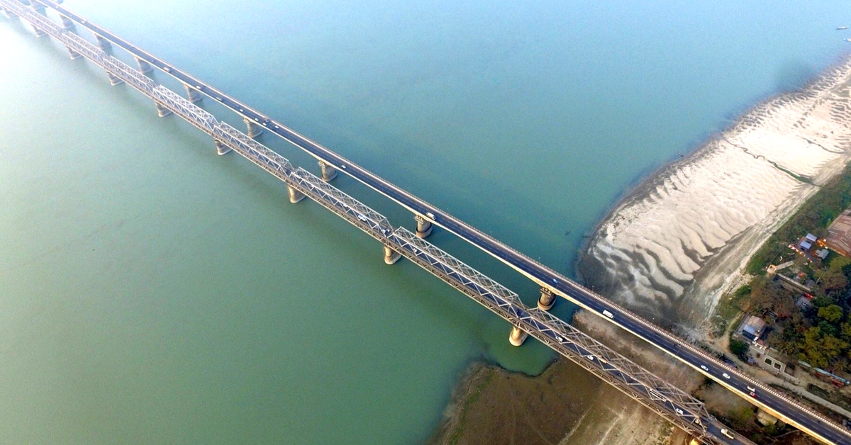
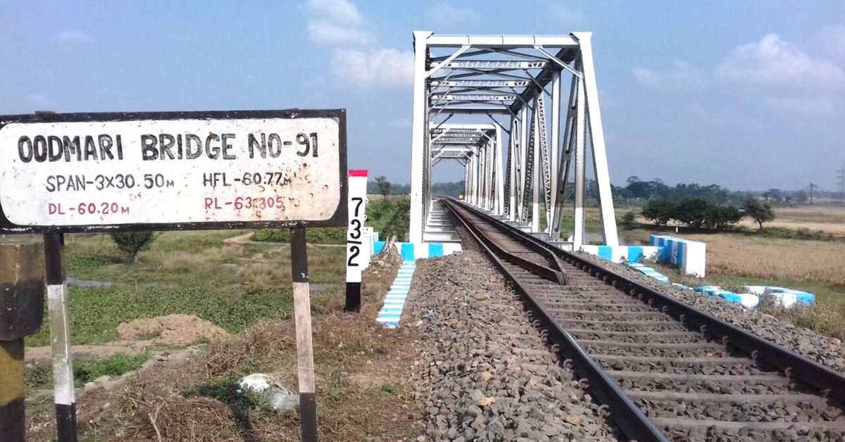
Check out the amazing photos, taken by the drone over Oodmari Bridge, among other places.
With thousands of kilometres of tracks laid out through the country, keeping them all in top shape is a tough task for the Indian Railways and the same is true when it comes to rescue and relief operations, as well.
The Indian Railways has decided to go hi-tech, and use drones to monitor projects, and rescue and relief operations.
Here are some amazing aerial photographs taken by the drone, during maintenance work at Oodmari Bridge, Saraighat Bridge and Dayang Bridge. The drones provide a vantage birds-eye view, so naturally, the image is breathtaking.
Cameras (UAV/NETRA) will be used for various railway activities especially project monitoring and maintenance of tracks and other railway infrastructure, the national transporter said in a statement, according to the News Minute.
The cameras will also judge the efficiency of Non-Interlocking works, help in crowd management during fairs, find scrap, and survey station yards.
The Western Railway is the first to be given the task to source the cameras, which will monitor the maintenance of tracks, keep an eye on relief and rescue operations, and also view inspection-related activities.
The real-time inputs provided by the drones would help with the safety and timely maintenance of tracks and other vital infrastructure.
A drone is essentially is a flying robot. They may be remote-controlled or can fly autonomously through software-controlled flight plans in their embedded systems working in conjunction with onboard sensors and GPS. Drones have tremendous potential. They can fly short distances quickly and can take jaw-dropping panoramic photos, thanks to their high-definition cameras.
Drones are being extensively implemented, in many areas of public service. The Tamil Nadu municipal administration has a project to map properties using drones and the West Bengal Government is using drones to identify places full of stagnant water, to eliminate mosquitoes.
The National Disaster Management Authority (NDMA) also held a day-long session in New Delhi in November 2017, on the application of Unmanned Aerial Vehicles (UAV) in disaster management. It was observed that UAVs could be used to identify disaster-affected areas and help in facilitating quick disaster-response.
You may also like:- Bengaluru Students Have Developed Drones That Douse Fire From the Sky, With “Fireballs”!
Civilians also love using drones, so much that the government has drafted a specific set of rules, for civilian drone use. All civilian drones are to have unique identification numbers, and radio frequency tags.
Let’s hope that drones are used productively, for the betterment of society, and let us hope that the sheer number of drones in the sky, doesn’t adversely affect the avian population.
Like this story? Or have something to share? Write to us: [email protected], or connect with us on Facebook and Twitter.
NEW: Click here to get positive news on WhatsApp!

Similar Story

Startup’s Innovation Could Help Millions Get Access to Better Brain Health At Home
Ivory, a pioneering age-tech startup founded by Issac John and Rahul Krishnan, aims to redefine the ageing experience by focusing on better brain health, through neuroscience-backed assessments, interactive games, and personalised solutions.
Read more >
If you found our stories insightful, informative, or even just enjoyable, we invite you to consider making a voluntary payment to support the work we do at The Better India. Your contribution helps us continue producing quality content that educates, inspires, and drives positive change.
Choose one of the payment options below for your contribution-
By paying for the stories you value, you directly contribute to sustaining our efforts focused on making a difference in the world. Together, let's ensure that impactful stories continue to be told and shared, enriching lives and communities alike.
Thank you for your support. Here are some frequently asked questions you might find helpful to know why you are contributing?

This story made me
-
 97
97 -
 121
121 -
 89
89 -
 167
167